


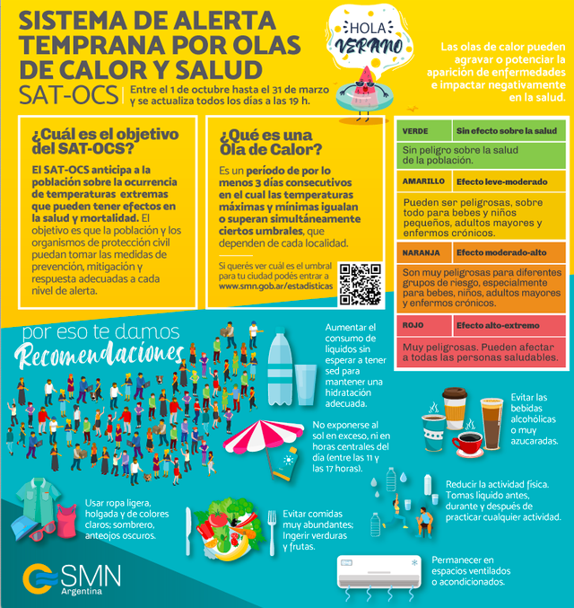
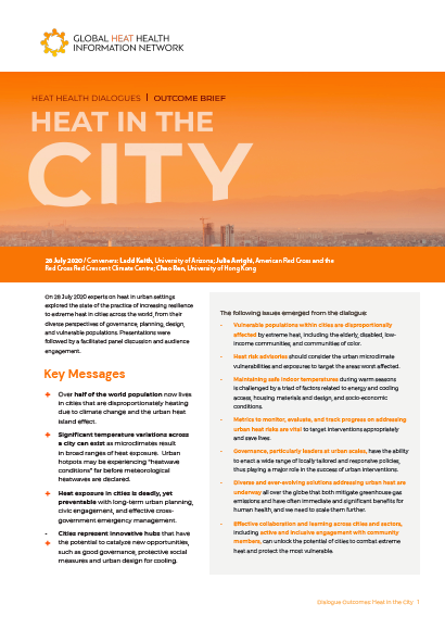
 40 ∘C in 68% of the observation days, a level which was never reached at the nearby campus of the Makerere University, and only a few times at the city outskirts. Large intra-urban heat stress differences are explained by satellite earth observation products. Normalized Difference Vegetation Index has the highest (75%) power to predict the intra-urban variations in daily mean heat stress, but strong collinearity is found with other variables like impervious surface fraction and population density. Our results have implications for urban planning on the one hand, highlighting the importance of urban greening, and risk management on the other hand, recommending the use of a temperature-humidity index and accounting for large intra-urban heat stress variations and heat-prone districts in urban heat action plans for tropical humid cities.


To better inform this tool, we conducted a robust literature review and user needs assessment to understand how the California Heat and Health Project can best inform and improve current efforts in all California regions. Our report outlines our key findings from this research including results from an online survey and interviews with public health, planning and emergency preparedness stakeholders throughout California.
Our research shows the limitations of emergency response to prevent the health impacts of heat waves. The greatest strides can be made through interventions planned well ahead of time, such as changes in the urban design and social programs. Therefore, we conclude that a new online decision support tool is best geared towards informing mid and long-term interventions to reduce the public health impacts of extreme heat.


